Summer is a time when we are all outside. The long, sunny days and warm weather make it hard to resist. This summer was one of the warmest. Parts of a Greenlandic glacier broke off and floated into Frobisher Bay, right up to the shore of Apex and Iqaluit. So for much of the summer, little icebergs floated on the water, white and blue ones. Blue ones connote multi-year ice, the ice that was part of a glacier for more than a year. Frobisher Bay has quite extreme high and low tides, so during the low tide the ice would sit on the mud in the bay. The shapes were amazing.
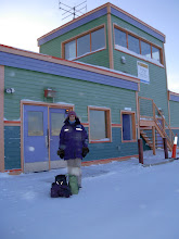
Summer is also a time for visiting. Alisse and Greg came for ten days in August and we took a trip to Pangnirtung and Auyuittuq National Park. They found that Nunavut is a place where things work a little differently, perhaps a place to move more slowly?...

Pangnirtung is an East Baffin Island community located at the mouth of the Pangnirtung Fjord, which drains into Cumberland Sound. From Pang then, you can look one way into the fjord and the mountains, home of Auyuittuq Park and the Akshayuk pass, and the other way out to Cumberland Sound. The water is so clear, it sparkles as blue as the Caribbean, though a tad colder. Our trip would have been worthwhile just for the flight, during which the plane comes so close to the mountains around Pang that it feels like you can reach out and touch them.


After a couple days rest and fortification with potato chips and Nutella, Greg, Alisse, and I joined forces with Mark and Meagan for a trek into Auyuittuq park, through Askshayuk Pass. Akshayuk Pass is the most popular hiking destination in Auyuittuq. The pass, which is 97 km long, connects Pangnirtung Fiord in Cumberland Sound (closest community is Pangnirtung), with North Pangnirtung Fiord off Davis Strait (closest community is Qikiqtarjuaq). It's a traditional Inuit travel corridor, where people would go to hunt caribou. It's a gelologically active place. This summer, it experienced severe erosion. One of the lakes, Summit Lake, around halfway up the corridor, breached and the water that flooded the basins toward Pang eroded the moraine that blocks another lake, Crater Lake, from spilling into the passand creating a flash flood. As a result, our chosed hiking destination, the southeast end of the pass, from the first emergency shelter at the mouth of the pass, Overlord, to Windy Lake, just south of Summit Lake, was closed to visitors. it reopened just before we set out on our hike.
A hike in Auyuittuq Park means a hike through rivers and up sand dunes. The river crossings require neoprene footgear and good cheer. You often have to travel up and downstream to find the best place to cross. It does, however, make for a great photo!

The rivers make for easy access to fresh water. Every day, I drank litres of delicious glaciar water. Here I am refilling our water store with the most excellent water pump that Mark and Meaghan own. Perhaps a funny photo, but it's a funny process.


1 comment:
Ok, you need much larger photos, m'dear! Also, I MISSED YOU! Thank goodness you're still updating this.
I wish we had money - if we win the lottery, we're coming to visit. I think Rowan would spend the entire time saying "Woah! Mommy! Did you see that?!" He thinks the world is a crazy-interesting place, and that physics, while often dangerous, presents endless opportunities for entertainment.
Post a Comment